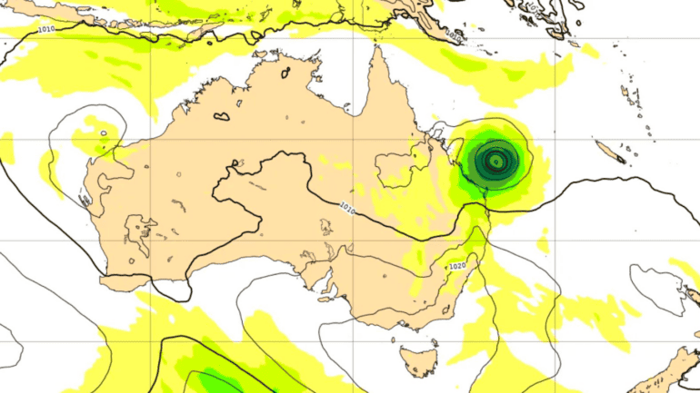
European artificial intelligence is forecasting the potential tropical cyclone forming off the coast of Queensland will track towards Rockhampton.
On Wednesday afternoon, the Bureau of Meteorology said there was a 60 per cent chance the low-pressure system would form off the Coral Sea by next Tuesday.
Stay up-to-date on the latest news with The Queensland Briefing – keeping you in the loop with news as it hits:
It’s currently too early for the Bureau to forecast the storm’s tracking, but Cairns-based community information officer for BOM, Daniel Hayes, said some modes had it tracking towards the coast.
“If it moves back towards the coast, probably somewhere between Cairns and Rockhampton is the more likely area for it to head towards,” he said.
“It’s not expected to have any direct impact on the coast within the next seven days”.
“[There is a] chance that it could actually intensify to become a severe tropical cyclone, which is category three or stronger.”
Artificial intelligence modelling from the European Centre for Medium-Range Weather Forecasts has the potential cyclone closer to Rockhampton by late next Thursday.
The modelling from the centre is in its trial phase, and is being tested against other traditional models of storm tracking.
Should a cyclone be formed, it will be named Kirrily.
The Bureau is advising communities on the east coast of Queensland to stay up to date with forecasts and warnings.
